
Maps
7 - 10
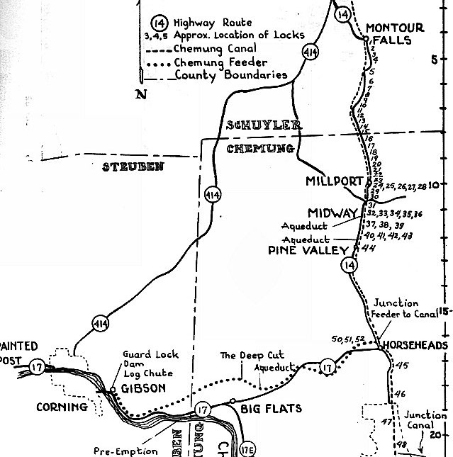


This map shows the line of the Chemung Canal and the feeder canal. The numbers indicate locks. There were 53 locks on the canal and feeder canal. Most of the locks were between Montour Falls, NY (known as Havana then) and Pine Valley since the ground rises 450 feet between those two points. The feeder canal joined the main canal in Horseheads, NY near Hanover Square, where the fire department is located today.
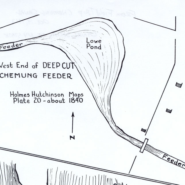
In Big Flats, the feeder canal entered Lowe Pond on the west side and exited the pond on the east side. The canal then crossed Kahler Road. Where it crossed Kahler Road was where the Deep Cut was located and the remains of it can still be seen today. The canal bed had to be dug down over 20 feet to keep the water flowing towards Horseheads and the main canal. Constructing the Deep Cut was difficult as it was a sea of mud that was difficult to excavate. Much of the excavation had to be done by hand and hauled by wheelbarrows as wagons and horses became mired in the mud making them useless.
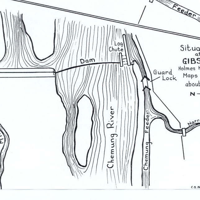
This map shows the canal at Gibson, NY near Corning. The dam on the Chemung River created a supply of water for the canal. A log chute allowed rafts of lumber to bypass the dam. The Guard Lock was also located here to let water into the feeder canal.
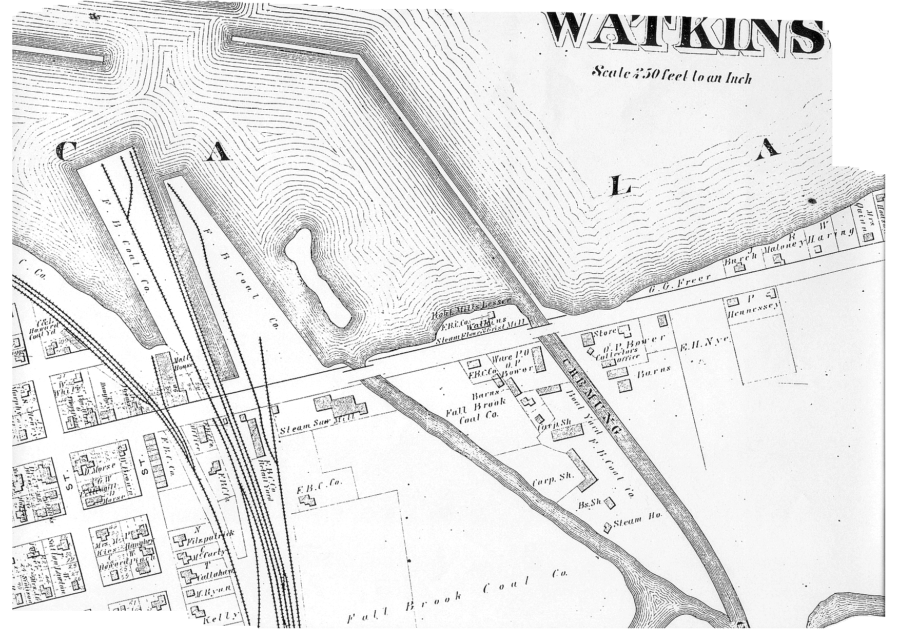
This map shows the Chemung Canal entering Seneca Lake in Watkins Glen. Canal boats tied up here to await towing up the lake by steamboats. John Magee had his Fallbrook Coal Company works at this spot.
This 1855 map shows the Chemung Canal in Havana, NY (present-day Montour Falls). The canal crossed Main Street where the current Post Office is located.
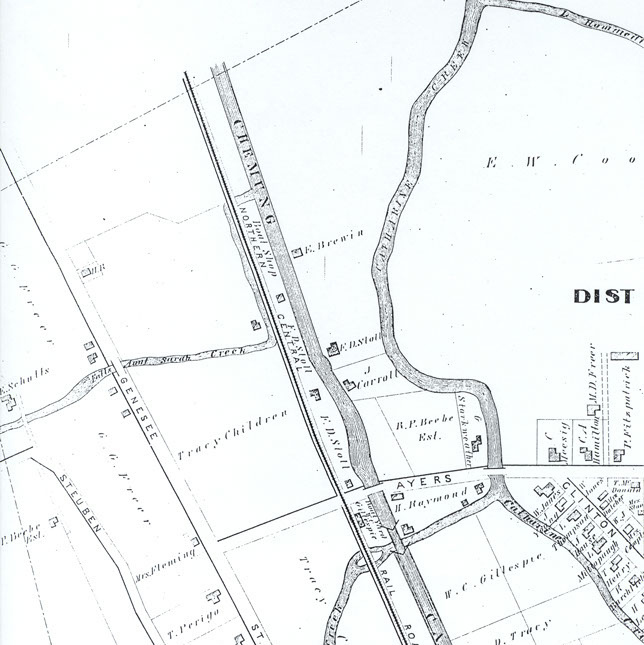
This map from 1857 shows the north end of Havana (Montour Falls) where Lock 1 was located. The marina channel in Montour Falls that carries boat traffic to Seneca Lake today was once part of the Chemung Canal. It was built in 1849-50 to bypass Catherine Creek. Prior to 1849, boats locked into Catherine Creek from Lock 1 to continue to Seneca Lake, but silt often caused the canal boats to get stuck in the creek, forcing the canal commissioners to approve construction of the canal to the lake in 1849.
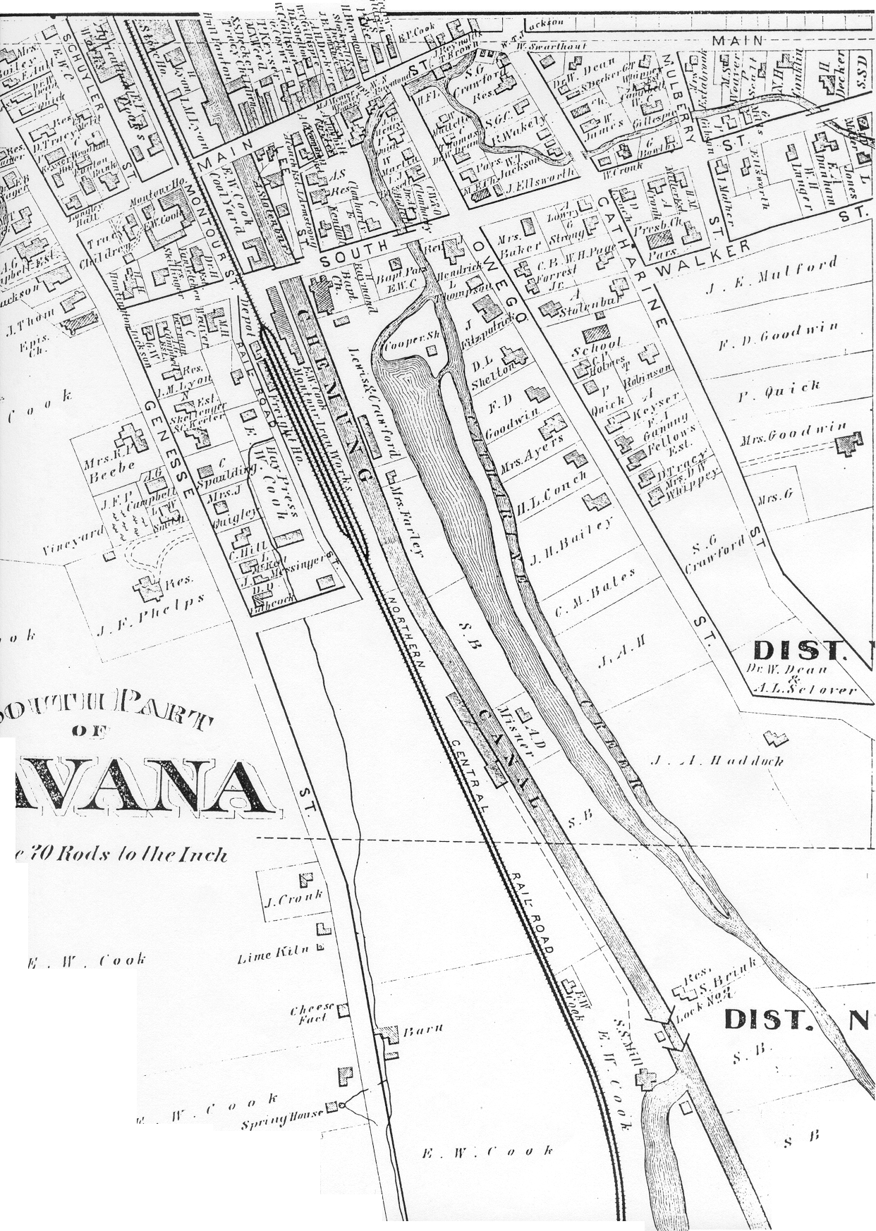
This map shows the south end of Havana (Montour Falls) in 1857. The large pond shown on the map was the mill pond for Charles Cook's flour mill located along the canal.
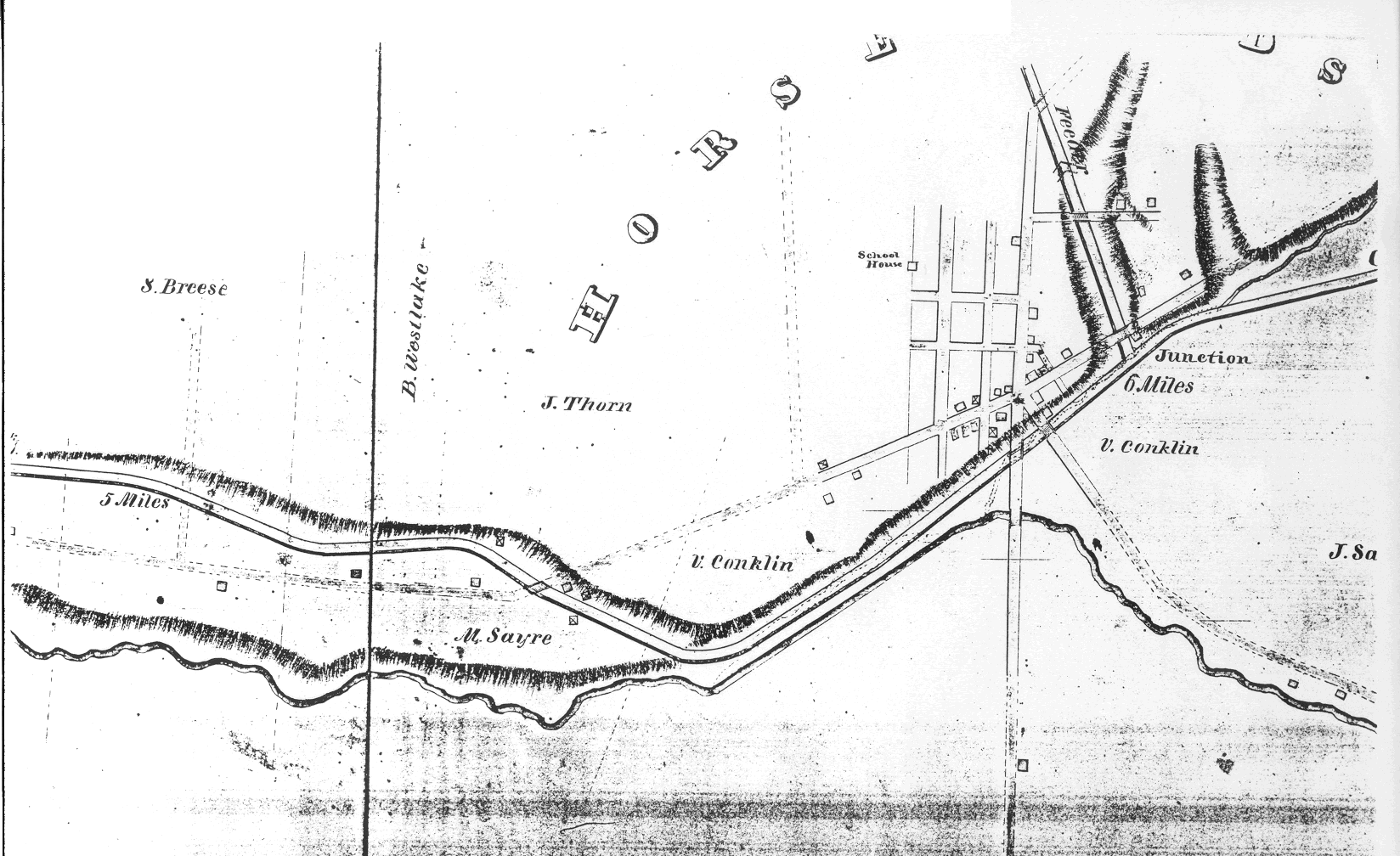
The map above shows the path of the Chemung Canal through Horseheads, NY. Newtown Creek ran right alongside the canal. The feeder canal joined the main canal just beyond Hanover Square in Horseheads where the fire department is today. A historical marker there tells about the two canals.
This 1855 map of Elmira, NY shows the canal's path through the city. Today, the Clemens Center Parkway follows the path of the canal.
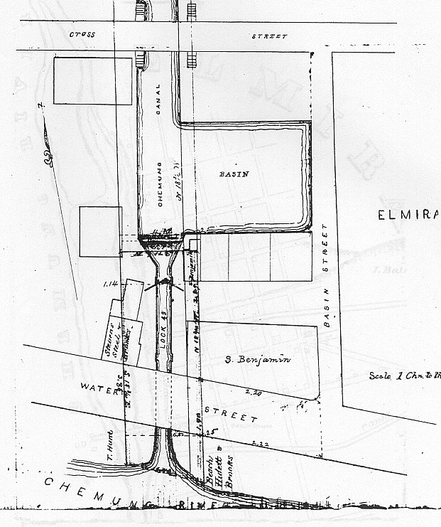
This map shows Lock 49, the spill lock, in Elmira. The water from the spill lock was carried under Water Street and to the Chemung River by a sluice pipe. Note the basin area where canal boats could tie up to load or unload. The basin was also a place where canal boats could turn around. Near the basin were hotels and saloons.
<
>
