![]()
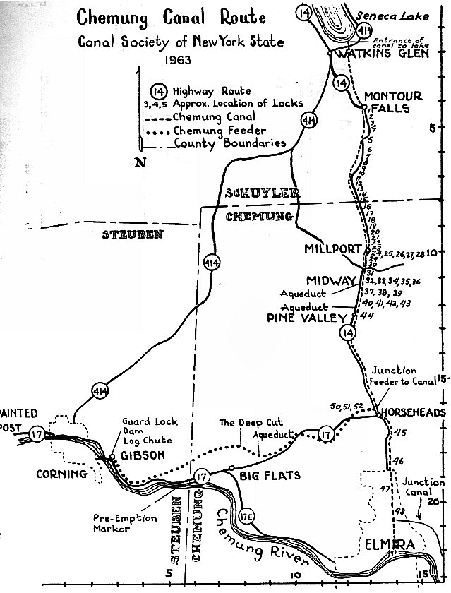
This map shows the Chemung Canal and the Feeder Canal. The numbers represent the
location of the locks on the canal. Notice the large number of locks between Montour Falls
Pine Valley. Between those two places the ground rises 450 feet making the many locks
necessary. All the locks made for slow going on the Chemung Canal, which is why the canal
was largely a freight canal, not a passenger canal. To travel from Elmira to Watkins Glen
on the Chemung Canal could take 3 days due to all the locks. The Feeder Canal brought water
from the Chemung River at Gibson to the main canal. The Feeder Canal met the main canal
in Horseheads where the fire department is located today.
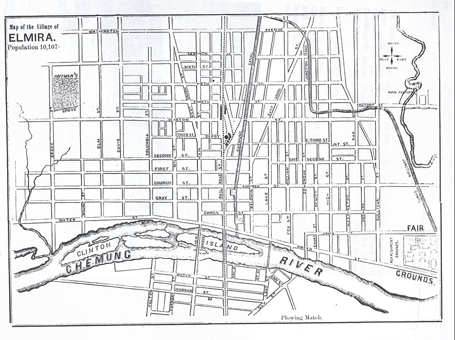
The map above shows Elmira in 1857. Where the canal was is now the Clemons Center Parkway. Lock 49 was
built to allow traffice to enter the river, but it was rarely used as the river was often too low to handle canal
traffic. Note the basins south of Cross Street and Church Street. Basins allowed canal boats to tie up to load
or unload and to turn around. Near the basins were hotels and saloons.
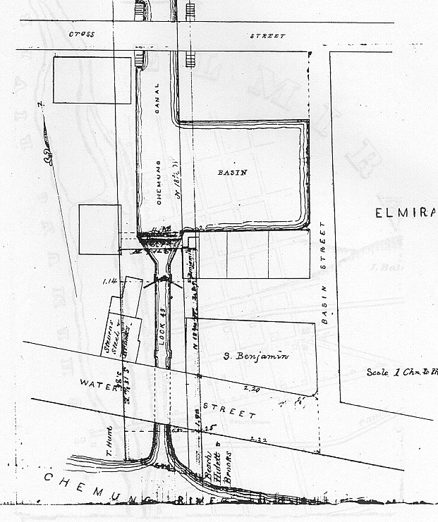
Lock 49 was the last lock on the canal and it was intended to let canal traffic use the
Chemung River. This lock was called the Spill Lock because canal water spilled over the
lock in a waterfall and was carried by a sluice pipe under water street and into the river.
The map shows the basin next to the lock.
You can see a picture of the Spill Lock on the
photos page.
